Assessment of hail damages in maize using remote sensing and comparison with an insurance assessment: A case study in Lombardy

Submitted: 24 June 2022
Accepted: 4 October 2022
Published: 30 December 2022
Abstract Views: 751
PDF: 305
HTML: 15
Publisher's note
All claims expressed in this article are solely those of the authors and do not necessarily represent those of their affiliated organizations, or those of the publisher, the editors and the reviewers. Any product that may be evaluated in this article or claim that may be made by its manufacturer is not guaranteed or endorsed by the publisher.

Authors

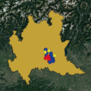
Studies have shown that the quantification of hail damage is generally inaccurate and is influenced by the experience of the field surveyors/technicians. To overcome this problem, the vegetation indices retrieved by remote sensing, can be used to get information about the hail damage. The aim of this work is the detection of medium-low damages (i.e., between 10 and 30% of the gross saleable production) using the much-used normalized difference vegetation index (NDVI) in comparison with alternative vegetation indices (i.e., ARVI, MCARI, SAVI, MSAVI, MSAVI2) and their change from pre-event to post-event in five hailstorms in Lombardy in 2018. Seventy-four overlapping scenes (10% cloud cover) were collected from the Sentinel-2 in the spring-summer period of 2018 in the Brescia district (Lombardy). An unsupervised classification was carried out to automatically identify the maize fields (grain and silage), testing the change detection approach by searching for damage by hail and strong wind in the Lombardy plain of Brescia. A database of 125 field surveys (average size 4 Ha) after the hailstorm collected from the insurance service allowed for the selection of the dates on which the event occurred and provided a proxy of the extent of the damage (in % of the decrease of the yield). Hail and strong wind damages ranged from 5 to 70%, and they were used for comparison with the satellite image change detection. The differences in the vegetation indices obtained by Sentinel 2 before and after the hailstorm and the insurance assessments of damage after the events were compared to assess the degree of concordance. The modified soil-adjusted vegetation index outperformed other vegetation indices in detecting hail-related damages with the highest accuracy (73.3%). On the other hand, the NDVI resulted in scarce performance ranking last of the six indices, with an accuracy of 65.3%. Future research will evaluate how much uncertainty can be found in the method’s limitations with vegetation indices derived from satellites, how much is due to errors in estimating damage to the ground, and how much is due to other causes.

Highlights
- The discovery rate of damaged fields improved.
- MSAVI outperformed NDVI and other vegetation indices, identifying 73.3% of occurrences.
- Estimation of damage from remote sensing was more accurate for fields severely affected >50%.
- In low-intensity hail events (<50 canopies affected), the MSAVI provided a detailed picture of the damage across the field.
- The proposed approach is promising to develop a ‘sampling map’ for detailed on-ground assessment.

Dimensions

Altmetric

PlumX Metrics

Downloads

Download data is not yet available.

Citations

Abendroth LJ, Elmore RW, Boyer MJ, Marlay SK, 2011. Corn growth and development. PMR 1009. Iowa State University Extension, Ames, IA, USA.
Adee EA, Paul LE, Nafziger ED, Bollero GA, 2005. Yield loss of corn hybrids to incremental defoliation. Online. Crop Manage. 4:1-9. DOI: https://doi.org/10.1094/CM-2005-0427-01-RS
Adnan M, Fahad S, Zamin M, Shah S, Mian IA, Danish S, Zafar-ul-Hye M, Battaglia ML, Naz RMM, Saeed B, Saud S, Ahmad I, Yue Z, Brtnicky M, Holatko J, Datta R, 2020. Coupling phosphate-solubilizing bacteria with phosphorus supplements improve maize phosphorus acquisition and growth under lime induced salinity stress. Plants 9:900. DOI: https://doi.org/10.3390/plants9070900
Andrade FH, Vega C, Uhart S, Cirilo A, Cantarero M, Valentinuz O, 1999. Kernel number determination in maize. Crop Sci. 39:453-9. DOI: https://doi.org/10.2135/cropsci1999.0011183X0039000200026x
Azzari G, Jain M, Lobell DB, 2017. Towards fine resolution global maps of crop yields: testing multiple methods and satellites in three countries. Remote Sens. Environ. 202:129-41. DOI: https://doi.org/10.1016/j.rse.2017.04.014
Battaglia M, Lee C, Thomason W, Van Mullekom J, 2019. Effects of corn row width and defoliation timing and intensity on canopy light interception. Crop Sci. 59:1718-31. DOI: https://doi.org/10.2135/cropsci2018.05.0337
Berti A, Maucieri C, Bonamano A, Borin M, 2019. Short-term climate change effects on maize phenological phases in northeast Italy. Ital. J. Agron. 14:222-9. DOI: https://doi.org/10.4081/ija.2019.1362
Botzen WJW, Bouwer LM, van den Bergh JCJM, 2010. Climate change and hailstorm damage: Empirical evidence and implications for agriculture and insurance. Resour. Energy Econ. 32:341-62. DOI: https://doi.org/10.1016/j.reseneeco.2009.10.004
Capitanio F, De Pin A, 2018. Measures of efficiency of agricultural insurance in Italy, Economic evaluations. Risks 6:126. DOI: https://doi.org/10.3390/risks6040126
Childs SJ, Schumacher RS, Demuth JL, 2020. Agricultural perspectives on hailstorm severity, vulnerability, and risk messaging in Eastern Colorado. Weather Clim. Soc. 12:897-911. DOI: https://doi.org/10.1175/WCAS-D-20-0015.1
Congalton RG, 1991. A review of assessing the accuracy of classifications of remotely sensed data. Remote Sens. Environ. 37:35-46. DOI: https://doi.org/10.1016/0034-4257(91)90048-B
Curry GN, Koczberski G, 2012. Relational economies, social embeddedness and valuing labour in agrarian change: an example from the developing world. Geogr. Res. 50:377-92. DOI: https://doi.org/10.1111/j.1745-5871.2011.00733.x
Drusch M, Del Bello U, Carlier S, Colin O, Fernandez V, Gascon F, Hoersch B, Isola C, Laberinti P, Martimort P, Meygret A, Spoto F, Sy O, Marchese F, Bargellini P, 2012. Sentinel-2: ESA’s optical high-resolution mission for GMES operational services. Remote Sens. Environ. 120:25-36. DOI: https://doi.org/10.1016/j.rse.2011.11.026
Erhardt R, Bell J, Blanton B, Nutter F, Robinson M, Smith R, 2019. Stronger climate resilience with insurance. Bull. Am. Meteorol. Soc. 100:1549-52. DOI: https://doi.org/10.1175/BAMS-D-19-0073.1
Erickson BJ, Johannsen CJ, Vorst JJ, Biehl LL, 2004. Using remote sensing to assess stand loss and defoliation in maize. Photogramm. Eng. Remote Sens. 70:717-22. DOI: https://doi.org/10.14358/PERS.70.6.717
EUROSTAT, 2021. Statistics | Eurostat. In: Crop Prod. Available from: https://ec.europa.eu/eurostat/databrowser/view/APRO_CPNH1__custom_1271804/default/line?lang=en Accessed: 8 September 2021.
Fabijańczyk P, Zawadzki J, 2022. Spatial correlations of NDVI and MSAVI2 indices of green and forested areas of urban agglomeration, case study Warsaw, Poland. Remote Sens. Appl. Soc. Environ. 26:2352-9385. DOI: https://doi.org/10.1016/j.rsase.2022.100721
Fadaei H, 2020. Advanced land observing satellite data to identify ground vegetation in a juniper forest, northeast Iran. J. For. Res. 31:531-9. DOI: https://doi.org/10.1007/s11676-018-0812-5
Furlanetto J, Ferro ND, Briffaut F, Carotta L, Polese R, Dramis A, Miele C, Persichetti A, Nicoli L, Morari F, 2021. Mapping of hailstorm and strong wind damaged crop areas using LAI estimated from multispectral imagery. In: Precision agriculture ‘21. Wageningen Academic Publishers, The Netherlands, pp 315-321. DOI: https://doi.org/10.3920/978-90-8686-916-9_37
Gallo K, Schumacher P, Boustead J, Ferguson A, 2019. Validation of satellite observations of storm damage to cropland with digital photographs. Weather Forecast 34:435-46. DOI: https://doi.org/10.1175/WAF-D-18-0059.1
Gaupp F, Pflug G, Hochrainer-Stigler S, Hall J, Dadson S, 2017. Dependency of crop production between global breadbaskets: a copula approach for the assessment of global and regional risk pools. Risk Anal. 37:2212-28. DOI: https://doi.org/10.1111/risa.12761
Gobbo S, Ghiraldini A, Dramis A, Dal Ferro N, Morari F, 2021. Estimation of hail damage using crop models and remote sensing. Remote Sens. 13:2655. DOI: https://doi.org/10.3390/rs13142655
Grotjahn R, 2021. Weather extremes that affect various agricultural commodities. In: Extreme Events and Climate Change. Wiley, pp 21-48 DOI: https://doi.org/10.1002/9781119413738.ch3
Hamar D, Ferencz C, Lichtenberger J, Tarcsai G, Ferencz-Árkos I, 1996. Yield estimation for corn and wheat in the Hungarian Great Plain using Landsat MSS data. Int. J. Remote Sens. 17:1689-99. DOI: https://doi.org/10.1080/01431169608948732
Hatfield JL, Gitelson AA, Schepers JS, Walthall CL, 2008. Application of spectral remote sensing for agronomic decisions. Agron. J. 100:0370c. DOI: https://doi.org/10.2134/agronj2006.0370c
Hov Ø, Cubasch U, Fischer E, Höppe P, Iversen T, Kvamstø NG, Kundzewicz ZW, Rezacova D, Rios D, Duarte Santos F, Schädler B, Veisz O, Zerefos C, Benestad R, Murlis J, Donat M, Leckebusch GC, Ulbrich U, 2013. Extreme weather events in Europe: preparing for climate change adaptation. Report produced by Norwegian Meteorological Institute in cooperation with EASAC. Available from: http://www.easac.eu/fileadmin/PDF_s/reports_statements/Extreme_Weather/Extreme_Weather_full_version_EASAC-EWWG_final_low_resolution_Oct_2013f.pdf
Johnson RR, 1978. Growth and yield of maize as affected by early‐season defoliation 1. Agron. J. 70:995-8. DOI: https://doi.org/10.2134/agronj1978.00021962007000060026x
Lauer JG, Roth GW, Bertram MG, 2004. Impact of defoliation on corn forage yield. Agron. J. 96:1459-63. DOI: https://doi.org/10.2134/agronj2004.1459
Leo S, Migliorati MDA, Grace PR, 2021. Predicting within-field cotton yields using publicly available datasets and machine learning. Agron. J. 113:1150-63. DOI: https://doi.org/10.1002/agj2.20543
Lesk C, Rowhani P, Ramankutty N, 2016. Influence of extreme weather disasters on global crop production. Nature 529:84-87. DOI: https://doi.org/10.1038/nature16467
Link J, Graeff S, Batchelor WD, Claupein W, 2006. Evaluating the economic and environmental impact of environmental compensation payment policy under uniform and variable-rate nitrogen management. Agric. Syst. 91:135-53. DOI: https://doi.org/10.1016/j.agsy.2006.02.003
Lobell DB, Azzari G, 2017. Satellite detection of rising maize yield heterogeneity in the U.S. Midwest. Environ. Res. Lett. 12:014014. DOI: https://doi.org/10.1088/1748-9326/aa5371
Lopresti MF, Di Bella CM, Degioanni AJ, 2015. Relationship between MODIS-NDVI data and wheat yield: a case study in Northern Buenos Aires province, Argentina. Inf. Process Agric. 2:73-84. DOI: https://doi.org/10.1016/j.inpa.2015.06.001
Lyubchich V, Newlands NK, Ghahari A, Mahdi T, Gel YR, 2019. Insurance risk assessment in the face of climate change: Integrating data science and statistics. WIREs Comput. Stat. 11:1462. DOI: https://doi.org/10.1002/wics.1462
Ma Z, Liu Z, Zhao Y, Zhang L, Liu D, Ren T, Zhang X, Li S, 2020. An unsupervised crop classification method based on principal components isometric binning. ISPRS Int. J. Geo-Inf. 9:648. DOI: https://doi.org/10.3390/ijgi9110648
Meier U, Bleiholder H, Buhr L, Feller C, Hack H, Heß M, Lancashire PD, Schnock U, Stauß R, van den Boom T, Weber E, Zwerger P, Peter Zwerger C, 2009. Das BBCH-System zur Codierung der phänologischen Entwicklungsstadien von Pflanzen - Geschichte und Veröffentlichungen. J. Kult. 61:41-52.
Molthan AL, Schultz LA, McGrath KM, Burks JE, Camp JP, Angle, K, Bell JR, Jedlovec GJ, 2020. Incorporation and use of earth remote sensing imagery within the NOAA/NWS damage assessment toolkit. Bull. Am. Meteorol. Soc. 101:E323-40. DOI: https://doi.org/10.1175/BAMS-D-19-0097.1
Nguy-Robertson A, Gitelson A, Peng Y, Viña A, Arkebauer T, Rundquist D, 2012. Green leaf area index estimation in maize and soybean: combining vegetation indices to achieve maximal sensitivity. Agron. J. 104:1336-47. DOI: https://doi.org/10.2134/agronj2012.0065
Nutini F, Confalonieri R, Paleari L, Pepe M, Criscuolo L, Porta F, Ranghetti L, Busetto L, Boschetti M, 2021. Supporting operational site-specific fertilization in rice cropping systems with infield smartphone measurements and Sentinel-2 observations. Precis. Agric. 1-20. DOI: https://doi.org/10.1007/s11119-021-09784-0
Österreichische Hagelversicherung, 2013. Österreichische Hagelversicherung, 27. Dezember 2013. In: Österreichische Hagelversicherung. Available from: https://www.hagel.at/
Peralta N, Assefa Y, Du J, Barden C, Ciampitti I, 2016. Mid-season high-resolution satellite imagery for forecasting site-specific corn yield. Remote Sens. 8:848. DOI: https://doi.org/10.3390/rs8100848
Prabhakar M, Gopinath KA, Reddy AGK, Thirupathi M, Rao CS, 2019. Mapping hailstorm damaged crop area using multispectral satellite data. Egypt J. Remote Sens. Sp. Sci. 22:73-9. DOI: https://doi.org/10.1016/j.ejrs.2018.09.001
Schillaci C, Tadiello T, Acutis M, Perego A, 2021. Reducing topdressing N fertilization with variable rates does not reduce maize yield. Sustain 13:8059. DOI: https://doi.org/10.3390/su13148059
Shah A, Agarwal R, Baranidharan B, 2021. Crop yield prediction using remote sensing and meteorological data. Proc. Int. Conf. Artif. Intell. Smart Syst. ICAIS 2021:952-60. DOI: https://doi.org/10.1109/ICAIS50930.2021.9395849
Sibley AM, Grassini P, Thomas NE, Cassman KG, Lobell DB, 2014. Testing remote sensing approaches for assessing yield variability among maize fields. Agron. J. 106:24-32. DOI: https://doi.org/10.2134/agronj2013.0314
Sosa L, Justel A, Molina Í, 2021. Detection of crop hail damage with a machine learning algorithm using time series of remote sensing data. Agronomy 11:2078. DOI: https://doi.org/10.3390/agronomy11102078
Szantoi Z, Geller GN, Tsendbazar NE, See L, Griffiths P, Fritz S, Gong P, Herold M, Mora B, Obregón A, 2020. Addressing the need for improved land cover map products for policy support. Environ. Sci. Policy 112:28-35. DOI: https://doi.org/10.1016/j.envsci.2020.04.005
Talukdar G, Sarma AK, Bhattacharjya RK, 2020. Mapping agricultural activities and their temporal variations in the riverine ecosystem of the Brahmaputra River using geospatial techniques. Remote Sens. Appl. Soc. Environ. 20:100423. DOI: https://doi.org/10.1016/j.rsase.2020.100423
Toeglhofer C, Mestel R, Prettenthaler F, 2012. Weather value at risk: on the measurement of noncatastrophic weather risk. Weather Clim. Soc. 4:190-9. DOI: https://doi.org/10.1175/WCAS-D-11-00062.1
Toreti A, Cronie O, Zampieri M, 2019. Concurrent climate extremes in the key wheat producing regions of the world. Sci. Rep. 9:5493. DOI: https://doi.org/10.1038/s41598-019-41932-5
Verrelst J, Rivera JP, Moreno J, Camps-Valls G, 2013. Gaussian processes uncertainty estimates in experimental Sentinel-2 LAI and leaf chlorophyll content retrieval. ISPRS J. Photogramm. Remote Sens. 86:157-67. DOI: https://doi.org/10.1016/j.isprsjprs.2013.09.012
Verrelst J, Rivera JP, Veroustraete F, Muñoz-Marí J, Clevers JGPW, Camps-Valls G, Moreno J, 2015. Experimental Sentinel-2 LAI estimation using parametric, non-parametric and physical retrieval methods - A comparison. ISPRS J. Photogramm. Remote Sens. 108:260-72. DOI: https://doi.org/10.1016/j.isprsjprs.2015.04.013
Vescovo L, Gianelle D, Dalponte M, Miglietta F, Carotenuto F, Torresan C, 2016. Hail defoliation assessment in corn (Zea mays L.) using airborne LiDAR. F. Crop Res. 196:426-37. DOI: https://doi.org/10.1016/j.fcr.2016.07.024
Vroege W, Finger R, 2020. Insuring weather risks in european agriculture. EuroChoices 19:54-62. DOI: https://doi.org/10.1111/1746-692X.12285
Vuolo F, Neuwirth M, Immitzer M, Atzberger C, Ng WT, 2018. How much does multi-temporal Sentinel-2 data improve crop type classification? Int. J. Appl. Earth Obs. Geoinf. 72:122-30. DOI: https://doi.org/10.1016/j.jag.2018.06.007
Vyas S, Dalhaus T, Kropff M, Aggarwal P, Meuwissen MPM, 2021. Mapping global research on agricultural insurance. Environ Res Lett. 16:103003. DOI: https://doi.org/10.1088/1748-9326/ac263d
Wang J, Ding J, Yu D, Ma X, Zhang Z, Ge X, Teng D, Li X, Liang J, Lizaga I, Chen X, Yuan L, Guo Y, 2019. Capability of Sentinel-2 MSI data for monitoring and mapping of soil salinity in dry and wet seasons in the Ebinur Lake region, Xinjiang, China. Geoderma 353:172-87. DOI: https://doi.org/10.1016/j.geoderma.2019.06.040
Xiong J, Thenkabail PS, Gumma MK, Teluguntla P, Poehnelt J, Congalton RG, Yadav K, Thau D, 2017. Automated cropland mapping of continental Africa using Google Earth Engine cloud computing. ISPRS J Photogramm. Remote Sens. 126:225-44. DOI: https://doi.org/10.1016/j.isprsjprs.2017.01.019

How to Cite

Schillaci, C., Inverardi, F., Battaglia, M. L., Perego, A., Thomason, W., & Acutis, M. (2022). Assessment of hail damages in maize using remote sensing and comparison with an insurance assessment: A case study in Lombardy. Italian Journal of Agronomy, 17(4). https://doi.org/10.4081/ija.2022.2126